GPS-coordinates parking-place
N65006.432′ E11040.598′ (decimal-minutes)
N65006’26” E11040’35” (degrees, minutes and seconds)
GPS coordinates MOHO: N65005.888 ‘E11039.898’
A marked path goes up to the locality, and is starting at the small hamlet Skråen on Kvaløya northeast on the island Leka, on the lower side of county road 562. The QR plate is placed at a small building, where one car can park outside. At the QR-signpost it is barely mobile coverage, and on the main locality (MOHO) there is no coverage.
The site is easiest reached by following the marked path, with stakes and white small plates, less than 1.5 km to the south-west to the coordinates specified above. You will then come to a real geological delicacy; the border between the former upper part of the mantle and the oceanic crust, the Moho discontinuity (see below), formed in the beginning of Paleozoik.
You start to walk on a cart road until you arrive an open grass yard (see photo below). You walk the left rim of it until you see a stake. From here you follow the path until you reach the locality at the given coordinates.

Glaciofluvial sediments
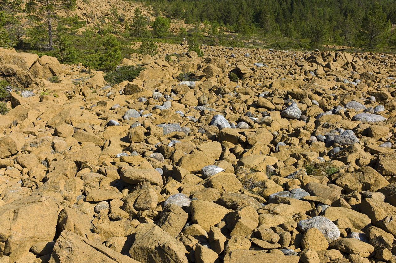
Along the way you will find a cobble field, at coordinates N650005.933′ E110039.942’, between 40 and 45 m asl. Her you will find both subangular and subroundet cobbles, which is typical of glaciofluvial sediments. The cobbles consist of fragments of extrusive rocks. The yellow-gray is basalt, dark inside and weathered at the surface, and the light is rhyolite, altered to quartz keratophyre.
Moho discontinuity
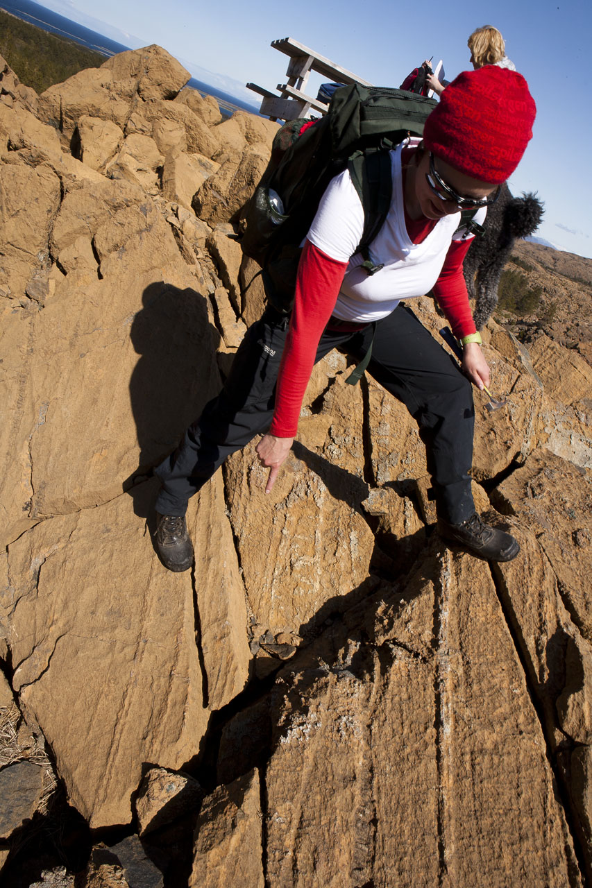
At this locality you can actually observe the boundary between the former oceanic crust and rocks from the upper part of the mantle. The left foot in the photo below is firmly planted in layered olivine-rich oceanic crust, called peridotite, while the right foot is placed in a more layered olivine-rich mantel-rock with a more rough surface. The interface between the two rocks is called the Moho discontinuity. The photos below is taken just south of the bench at the locality. In the first you see Rikke pointing on the discontinuity. In the second you see the different rocks on both sides of the Moho.

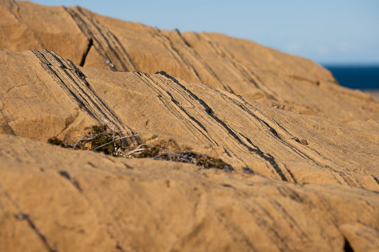
If you climb up some few meters to the west you can find black bands of the chromium mineral chromite in the oceanic crust-rock (see photo below).